A Volcano Begins Before There Is a Mountain
A volcano can look like a neatly pointed mountain, a broad swell in the landscape, or a crack releasing lava across a plain. Those different appearances share a deeper beginning: some rock beneath Earth’s surface melts, the resulting magma moves, and part of it eventually reaches the exterior. The difficult step is not explaining why hot liquid rises. It is explaining how mostly solid rock produces that liquid in the first place, and why the process happens in particular regions. Moving tectonic plates, changing pressure, and water carried into the interior supply several answers. Following those mechanisms from the mantle to the surface reveals why volcanoes cluster around ocean basins, build chains of islands, and sometimes grow far from an obvious plate boundary.
Most of the Mantle Is Solid Rock
Earth’s mantle is hot, but heat alone does not make the whole layer an underground ocean of lava. Pressure also influences whether minerals remain solid. At great depth, rock can be far hotter than temperatures familiar at the surface while still retaining a solid mineral structure. Over geological time, that solid material can deform and flow. Slow deformation and melting are different processes, even though both help explain the behavior of Earth’s interior.
Magma commonly forms by partial melting. A rock contains several minerals, and its components do not all enter a liquid phase simultaneously. A limited fraction can melt while a solid residue remains. The liquid therefore has a composition different from its source. This separation is an early reason why an erupted lava cannot be read as a straightforward scoop of the mantle immediately underneath the volcano.
The question becomes what changes the balance among temperature, pressure, and composition. Raising temperature can encourage melting, but decreasing pressure or adding substances such as water can do so as well. These alternatives explain volcanic regions more effectively than a single picture of heat punching through the crust. The USGS overview of the dynamic planet connects the principal settings to plate motion and magma production.
Pulling Plates Apart Can Release Melt
At a mid-ocean ridge, neighboring plates separate and mantle material rises to occupy the opening beneath them. As that material ascends, the surrounding pressure decreases faster than its temperature drops. It can cross into conditions where a fraction melts without receiving a fresh burst of heat. This process, decompression melting, supplies much of the magma that builds new oceanic crust. The resulting volcanism is largely hidden underwater, so Earth’s most extensive volcanic activity is not represented well by photographs of dramatic mountains on land.
Continental Rifts Expose a Similar Pressure Story
A continent can also stretch and thin. Faults accommodate the extension, the surface may develop long basins, and mantle can rise beneath the thinning lithosphere. Decompression can produce magma there as well. The outcome depends on the amount of extension, mantle temperature, and the crust encountered during ascent. A rift is a tectonic setting, not a guarantee that every segment will host an erupting volcano.
Continental crust adds complications absent from a simple ridge sketch. Magma may stall, cool, mix with another batch, or exchange material with surrounding rock. Some melts become richer in silica, changing how readily they flow and how they retain gases. Volcanic centers in a rift may consequently look quite different from one another. The shared origin mechanism does not require an identical eruption style or a single shape repeated along the entire rift valley.
Sinking Plates Help the Overlying Mantle Melt
Where an oceanic plate descends beneath another plate, it carries minerals that contain water into warmer, higher-pressure conditions. As those minerals transform, they release water-rich fluids. The fluids rise into the mantle above the descending slab and help lower the temperature at which that mantle can begin melting. This is often called flux melting. The central idea is a change in the conditions for melting, rather than a cold slab simply becoming a pool of liquid rock.
The magma produced above a subduction zone can move toward the surface and feed a volcanic arc. An arc may stand on a continent or form a chain of islands. Its position reflects the geometry of the descending plate and the processes operating above it. The volcanoes are not necessarily located directly along the trench visible on a map. The trench marks the plate boundary at the surface, while magma generation occurs deeper and farther inland.
That distinction prevents a common mistake about the Pacific Ring of Fire. It is a broad arrangement of tectonic boundaries and volcanic systems, not one connected circular magma reservoir. Different segments have different plate configurations, histories, and hazards. A volcano in Japan and one in the Andes can share a subduction-related explanation without sharing a plumbing system. Geological categories connect the mechanisms while preserving the individuality of each volcanic region.
The USGS account of magma beneath Alaskan volcanoes describes water released from the descending Pacific plate and explains how erupted rocks record subsequent underground processing. Those rocks are evidence of a changing system. Their crystals and chemical variations help reconstruct conditions that cannot be watched directly. Understanding an arc therefore requires both its tectonic position and the smaller-scale history recorded by its products.
Hotspots Can Build Volcanoes Within Plates
Some volcanic chains develop away from active plate boundaries. Hawaii is the best-known example: volcanic activity remains concentrated in a region while the Pacific plate moves across it, carrying older volcanoes away from their principal magma supply. A relatively persistent source of unusually hot mantle can explain such a chain, although the details of individual hotspots remain research questions. The USGS explanation of hotspots uses the Hawaiian sequence to show how age and location preserve the relationship between volcanism and plate motion. A hotspot is an explanation of localized magma production, not a hole that must remain perfectly motionless forever.
Magma Must Find a Route Through Solid Rock
Producing melt does not guarantee an eruption. Small quantities first separate from the surrounding minerals and collect into larger pathways. Buoyancy helps because many magmas are less dense than the rock around them, but pressure and fractures also influence their movement. Magma can open cracks, exploit existing weaknesses, or stop where the surrounding conditions no longer favor ascent. A volcanic system includes these pathways and storage regions as well as the visible vent.
Underground storage is often more complicated than a large empty cavern filled with liquid. A region may contain crystals, melt, and gases in changing proportions, with different bodies connected intermittently. New magma can enter while older material cools and crystallizes. Some of that material never erupts and instead solidifies underground. The exposed volcano is therefore only one possible destination for magma, and usually only the smallest visible part of the broader geological system.
Crystals are useful records of that hidden history. Their chemistry can change as temperature, pressure, and surrounding melt change, preserving layers or boundaries that researchers examine later. The record does not provide a perfect movie of every underground event. It does, however, help distinguish a simple uninterrupted ascent from a longer history of storage and mixing. The study of a volcano starts with surface observations but repeatedly leads back beneath the ground.
These underground pathways also explain why distance from the summit alone cannot describe the entire system. A fracture may carry magma sideways before it turns upward, placing a new vent beyond the older cone. Geological mapping identifies past pathways, while monitoring searches for signs that material is moving again. Neither method assumes that a volcano’s plumbing is permanently fixed. The changing connections are part of the mechanism that converts a local melt source into a landscape with a long and sometimes complicated eruptive history.
Gas Expansion Helps Determine Eruption Style
Magma can contain dissolved water, carbon dioxide, and other volatile substances. Under high pressure, these components can remain dissolved in the melt rather than forming separate gas bubbles. As it approaches lower pressure, some of those substances separate into bubbles. The expansion of gas can drive an eruption, but its effect depends on how easily it escapes. Fluid magma may release gas comparatively readily and spread in flows. More viscous magma can hinder escape, allowing pressure to build before fragmentation sends ash and other material into the air.
Silica content, temperature, crystals, and gas abundance all affect the behavior of the mixture. These factors interact, so a broad rock label cannot predict every eruption by itself. A volcano that has produced lava flows can later produce an explosive event under different conditions. Conversely, the presence of gas does not require a towering eruption column every time. The USGS introduction to volcanic processes explains buoyancy and gas expansion as related parts of magma’s ascent.
Repeated Eruptions Build Different Landforms
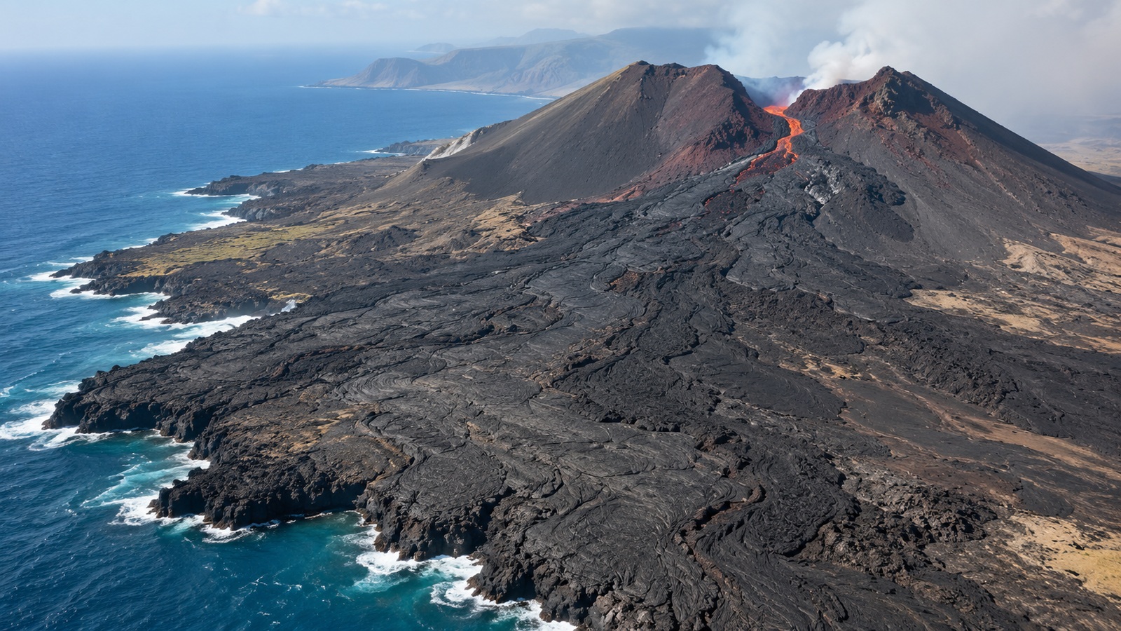
A shield volcano develops when repeated relatively fluid lava flows spread over broad distances, building a low, wide profile. A steep composite volcano accumulates an assortment of lava and fragmented material over many eruptions. A cinder cone can grow comparatively quickly around a vent through the accumulation of ejected fragments. None of these shapes is created by the ordinary folding of crust that builds many nonvolcanic mountain ranges. The shape records what the vent has supplied and how far that material has traveled.
Collapse and Erosion Continue the Story
Volcanic construction is accompanied by destruction. A summit area can collapse when support is lost above a magma storage region, forming a caldera. Slopes can fail, rivers can cut into deposits, and waves can attack island coasts. A recognizable cone may eventually disappear even though volcanic rocks remain. The landform seen today is the balance between material added during eruptions and material removed or rearranged afterward.
New vents may open away from an older summit, and lava can bury earlier features. A volcanic field may contain numerous separate cones rather than one towering central mountain. Some eruptions emerge through long fissures that build extensive lava plains. These arrangements remind us that a volcano is fundamentally associated with the movement and eruption of magma. A beautiful symmetrical cone is one possible result, rather than the definition every example must satisfy.
The USGS discussion of the nature of volcanoes distinguishes magma underground from lava at the surface and relates volcanic landforms to erupted products. Naming those products carefully is useful when reading a landscape. A smooth-looking flow, a loose ash deposit, and a welded layer preserve different conditions of transport and cooling. The terrain becomes more understandable when its materials are treated as evidence of processes instead of interchangeable volcanic rubble.
Formation Explains Where to Look, Not When to Expect an Eruption
Knowing a volcano’s origin gives scientists an essential geological framework. Monitoring then asks a different question: what is changing in that particular system now? Earthquakes, ground deformation, gas emissions, and thermal observations can indicate magma movement or altered fluid conditions. Their meaning depends on local history and on how several signals develop together. A tectonic map alone cannot provide a reliable date for the next eruption.
Volcanoes form because Earth’s interior and moving surface continually create places where rock can partially melt, collect, and ascend. Ridges lower pressure, subduction introduces fluids, and hotspots concentrate mantle heat. The resulting magma then encounters a distinct path through the crust before building or reshaping a landform. That sequence unites a quiet submarine flow, a broad Hawaiian shield, and an explosive volcanic arc while preserving their differences. Understanding the sequence makes volcanic landscapes more legible without reducing their behavior to a single universal eruption recipe.